What a Possible La Niña Could Mean for Canada This Winter
As Canadians, we know our winters are anything but predictable. Some years bring endless snow, while others swing between rain, ice, and sudden thaws. One of the biggest drivers of these seasonal shifts is what’s happening far away in the Pacific Ocean. Right now, meteorologists are watching for signs of La Niña—a recurring climate pattern that can tip the odds toward colder, stormier, or snowier conditions depending on where you live. Even a weak La Niña can play a role in shaping our Canadian winter, so let’s unpack what this means, why it happens, and how it has affected us in the past.
⸻
How La Niña Works
La Niña occurs when sea surface temperatures in the central and eastern tropical Pacific drop at least 0.5 °C below average for several months (NOAA). This cooling strengthens the Pacific trade winds and shifts atmospheric pressure patterns. The ripple effect? The jet stream gets nudged north and then dips southward over western and central Canada, steering Arctic air and Pacific moisture right across the country (weather.gov, climate.gov).
⸻
What It Could Mean Across Canada
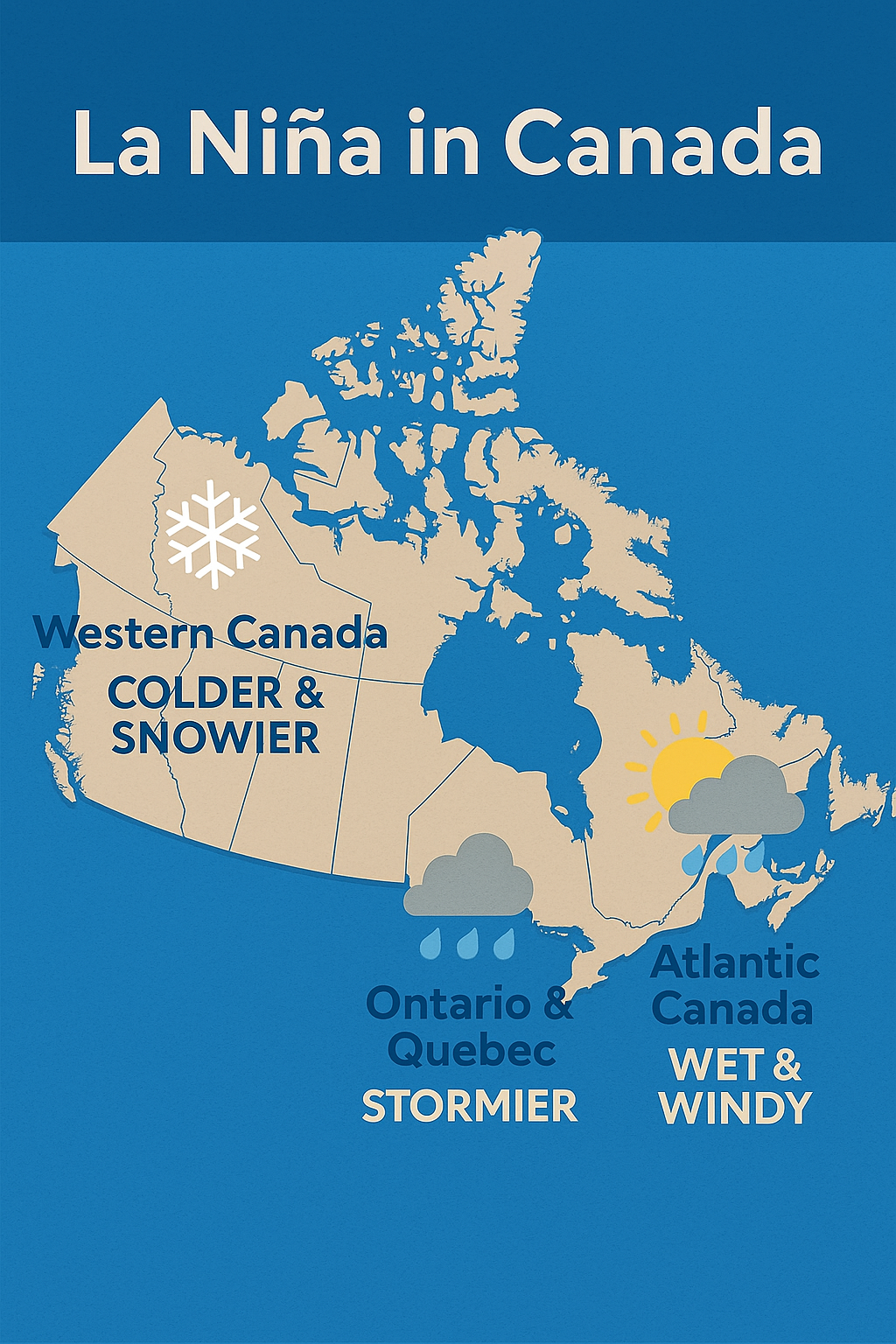
Western Canada (BC, Prairies, Rockies)
La Niña winters typically bring colder-than-average temperatures and heavier snowfall. Western Canada is often hit hardest, with the Rockies and Prairies seeing persistent Arctic air masses and active storm tracks delivering frequent snow events (climate.gov).
Eastern Canada (Ontario & Atlantic Provinces)
The same jet stream pattern tends to produce a stormier, wetter winter in the east. That can mean more snow for Ontario and Quebec and a mix of heavy snow and rain events along the Atlantic seaboard. These storm tracks are often stronger and more frequent in La Niña winters (theweathernetwork.com, severe-weather.eu).
Northern Canada & Other Regions with Less Impact
In regions like northern territories (Yukon, NWT, Nunavut), La Niña tends to have a much weaker influence, because the winter climate there is already dominated by Arctic air and persistent cold. Changes due to ENSO may be minimal compared to local variability.
⸻
A Look Back: La Niña Winters You Might Remember
• 2017–2018: A classic La Niña winter delivered bitter cold and heavy snow across Canada, followed by a wetter-than-normal spring in the Prairies.
• 2007–2008: Another moderate La Niña, known for prolonged snow cover in western Canada and increased ice thickness in Lakes Erie and Ontario.
• 2010–2011: Western Canada was buried under repeated snowfalls, while the east saw frequent storms that alternated between heavy snow and freezing rain.
If you lived through any of these winters, chances are you remember the long shoveling sessions, icy commutes, or endless snow days.
⸻
Why This Matters for You
La Niña isn’t a guarantee—but it does stack the deck. For westerners, that means prepping early for snow tires, snow boots, and the likelihood of long stretches of cold. For easterners, it’s about being ready for a stormier pattern with possible power outages, messy snow-rain mixes, and frequent systems rolling through. In the north, expect a winter that follows typical Arctic variability—where local conditions still reign supreme.
⸻
What Forecasts Are Saying Right Now
Current outlooks from NOAA and global agencies indicate there’s roughly a 50% chance La Niña will develop between October and January—a better-than-even likelihood, but far from certain (opensnow.com, newsweek.com). Some forecasts even suggest that chance could rise to about 60% by October–December (wmo.int). If La Niña doesn’t materialize and conditions remain ENSO-neutral, Canada may follow more average winter patterns: snow, cold, and storms—but with less predictability and no strong regional tipping points.
⸻
What a “Typical” Canadian Winter Looks Like
Here’s a quick snapshot, based on long-term climate data:
• Southern Ontario & Quebec: Cold, snowy winters with daily highs around −6 °C to 0 °C. Snowfall is substantial due to lake-effect and Atlantic moisture. (Britannica)
• Prairies (Winnipeg): Long, very cold, frequently snowy—January lows average around −16 °C, with many days below −30 °C. (Wikipedia)
• Calgary: Cold but variable—average January temps hover near −8 °C, though Chinook winds can warm days dramatically. (Wikipedia)
• Coastal BC (Vancouver): Milder, rainier winters—with average highs around 3 °C. Snow is rare at sea level but heavier in mountains. (Wikipedia)
• Atlantic Canada: Winters are cold, snowy, and stormy—with frequent nor’easters and heavy snowfall (e.g., Sydney averages over 280 cm per winter). (Wikipedia, Wikipedia)
⸻
Your Turn
What’s the most memorable La Niña winter you’ve experienced? Was it knee-deep powder in the Rockies, or back-to-back storms in the Maritimes? Share your story—your experience might be the perfect example of how a global climate driver plays out in your own backyard.
⸻
Sources:
• NOAA: What are El Niño and La Niña?
• NOAA Weather Service: La Niña mechanics
• Climate.gov: La Niña & snowfall
• The Weather Network: Canada winter patterns
• Severe-Weather.eu: ENSO winter impact
• Opensnow, Newsweek & WMO: La Niña forecast probabilities, Newsweek, WMO
• Britannica: Canada climate overview
• Wikipedia: Winnipeg climate, Calgary, BC, Sydney, Moncton
